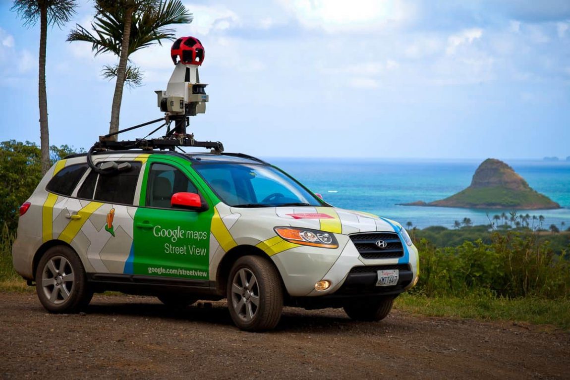
- Google Street View, a feature of Google Maps and Earth, offers interactive panoramas from streets worldwide.
- Since its 2007 launch in the U.S., it has expanded globally, utilizing diverse capture methods like cars, trikes, and even camels.
- Street View's evolution includes face-blurring technology, user-contributed panoramas, and environmental monitoring.
- Despite its technological marvels, it has faced privacy and legal challenges globally.
The Evolution of Google Street View
Google Street View, a revolutionary technology featured in Google Maps and Google Earth, has transformed how we view and navigate our world. Launching in May 2007 in the United States, Street View began as an ambitious project to offer panoramic street-level imagery. Today, it covers major cities and rural areas across the globe.
Capturing the World: A Diverse Approach
The technology behind Street View is as fascinating as the images it captures. Primarily, photography is done by car, but Google has employed various means to traverse different terrains:
- Trikes and Backpacks: For areas inaccessible by car, such as narrow streets or pedestrian paths.
- Specialized Vehicles: Snowmobiles for snowy regions and boats for water bodies.
- Camel and Underwater Cameras: Employed for deserts and underwater locations, showcasing Google's commitment to covering the most remote areas.
Technological Milestones
- Face-Blurring Technology: In 2008, Google introduced an algorithm to blur faces in Street View imagery, addressing privacy concerns.
- Indoor Views and User Contributions: Since May 2011, Google has allowed businesses to add interior views and users to contribute their own panoramas.
- Environmental Monitoring: Partnering with Aclima in 2015, Google added air quality sensors to its vehicles, blending environmental data collection with mapping.
Interface and Accessibility
- Pegman – The Iconic Interface: The Pegman icon, a staple of the Street View experience, serves as a playful and user-friendly interface element.
- Mobile and Web Integration: Accessible through Android, iOS, and web platforms, Street View has consistently evolved to remain technologically relevant.
Privacy and Legal Challenges
Despite its utility, Google Street View has faced significant privacy and legal challenges:
- Blurring Requests: Google allows users to request blurring of their homes, responding to privacy concerns.
- International Legal Issues: Countries like Austria, Australia, and Germany have imposed restrictions or temporarily halted Street View due to privacy and data collection concerns.
- Balancing Public and Private: The height of cameras and the detail of images captured have been points of contention in various regions.
The Global Reach of Street View
Google Street View's expansive coverage includes diverse and remote locations:
- Global Coverage: As of 2017, it captured over 10 million miles across 83 countries.
- Special Projects: Documenting areas like the Grand Canyon, underwater coral reefs, and even the International Space Station.
- Local Revivals: In regions like India, Google relaunched Street View in collaboration with local businesses, adapting to regional norms and regulations.
Technological Innovations in Imaging
Google's relentless innovation in camera technology has been central to Street View’s success:
- Advanced Camera Systems: From 11-megapixel CCD sensors to 20MP cameras in 2017, each iteration has enhanced image clarity and detail.
- Positioning and 3D Mapping: Integration of GPS, laser range scanners, and LIDAR technology ensures precise mapping and dimensional accuracy.
Conclusion: Street View's Ongoing Journey
Google Street View stands as a testament to technological progress and innovation. As it continues to expand and improve, it not only offers us a window into the world’s streets but also reflects our society's evolving relationship with technology, privacy, and digital mapping.


