The Magic Above: The Art and Science of Aerial Photography
Key Takeaways
- Early Beginnings: Aerial photography, pioneered by French balloonist Nadar in 1858, has evolved significantly, showcasing its importance in various fields.
- Technological Advancements: From balloons to drones, technological progress has expanded the capabilities and applications of aerial photography.
- Military Importance: First used extensively in World War I for reconnaissance, aerial photography has proven essential in military strategy.
- Commercial and Scientific Use: Today, it’s vital in cartography, environmental studies, and even real estate, showing landscapes and properties from unique perspectives.
- Regulations and Future: Understanding and adhering to regulations in aerial photography ensures safety and privacy, while technological innovations continue to shape its future.
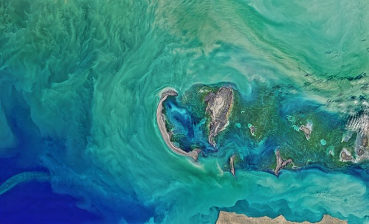
Floating effortlessly above the earth, my camera poised, I capture a moment frozen from a perspective few have witnessed. There’s something undeniably magical about aerial photography that transforms the mundane into the extraordinary. The first time I sent a drone spiraling into the sky, I was hooked. Below me, landscapes transformed into intricate tapestries, and ordinary scenes morphed into abstract art.
The Dance of Light and Shadow from Above
Imagine soaring high above the Giza pyramid complex, just as photographer Eduard Spelterini did in his balloon in 1904, capturing the timeless majesty of ancient structures. Each photograph is a slice of history, telling tales of times when these monumental achievements were undreamed of.
The Bird’s Eye Revolution: From Balloons to Drones
It all began with a bold ascent over Paris by Nadar in 1858, marking the birth of aerial photography. These early adventurers in balloons and kites paved the way for the drones and high-tech cameras we use today. Each advancement brought us a step closer to the clouds, changing our visual and perceptual horizons.
Consider the evolution from kites rigged with simple cameras to sophisticated drones buzzing through our skies, equipped with high-resolution cameras capable of capturing every detail from great heights. The journey from Nadar’s balloon to today’s UAVs encapsulates a history of relentless curiosity and technological triumph.
War from the Skies: The Military’s Eye
During World War I, aerial photography became a strategic tool. Airborne cameras, mounted on biplanes, provided crucial intelligence. From revealing enemy positions to planning battle strategies, the bird’s-eye view offered a significant advantage that map sketches couldn’t match.
I often think about those early military photographers, braving open cockpits with their bulky cameras, racing against time and enemy fire to deliver photographs that could turn the tide of war.
Peacetime Pursuits: Mapping the World
In times of peace, aerial photography flourished in new fields. Cartographers used these photographs to craft more accurate maps. Environmentalists monitored changes in ecosystems, and archaeologists spotted hidden ruins buried for millennia.
Each flight I undertake, mapping new terrains or inspecting environmental projects, reinforces the indispensable role aerial photography plays in understanding and managing our environment.
Navigating the Modern Skies: Regulations and Responsibilities
As the skies became crowded with drones, the need for regulation grew. Each country’s rules—be it the FAA in the United States or CASA in Australia—ensure that the freedom to explore from above does not encroach on safety or privacy.
I remember my first flight with a registered drone; the weight of responsibility was palpable, knowing each shot had to respect the delicate balance between innovation and intrusion.
Reflections from the Clouds
Every time my drone ascends, the world below offers endless stories, each waiting to be told through my lens. Aerial photography is not just about the technology or the stunning visuals it can produce; it’s about the unique perspectives it provides—a reminder of our place in the vast tapestry of life.
Do you ever wonder what secrets the birds see, secrets that only the heights can reveal?
Frequently Asked Questions
Q1: What was the first aerial photograph ever taken?
The first successful aerial photograph was “Boston, as the Eagle and the Wild Goose See It,” taken in 1860 by James Wallace Black and Samuel Archer King from a balloon.
Q2: How has aerial photography impacted military operations?
Aerial photography has been crucial for military reconnaissance, providing detailed views of enemy lines and strategic locations, significantly impacting planning and operations.
Q3: Can I legally take aerial photographs anywhere?
Laws vary by country, but typically, aerial photography is subject to regulations concerning safety, privacy, and airspace control. Always check local regulations before flying a drone or other aerial platform.
Q4: What types of drones are best for aerial photography?
For professional quality, multi-rotor drones like the DJI Phantom or Mavic series are preferred for their stability and high-quality imaging capabilities.
Q5: What are the future trends in aerial photography?
Future trends include the integration of AI for automated image analysis, improved drone battery


