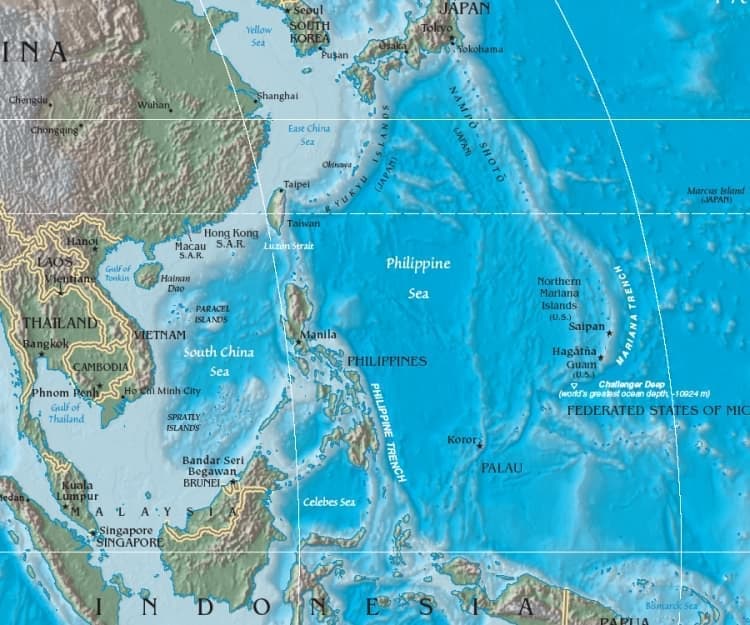
The Mariana Islands are an arc-shaped archipelago in the western Pacific Ocean, made up of the summits of fifteen volcanic mountains. They sit between Japan and New Guinea, along the 145th meridian east, and form the eastern edge of the Philippine Sea. The chain is known both for its extreme ocean depths and for its long history of human migration, colonial rule, and strategic military use.
- An island chain built from volcanic peaks rising out of deep ocean water.
- Located north of the equator in the western Pacific, between Japan and New Guinea.
- Includes territories with distinct political status, especially Guam and the Northern Mariana Islands.
- Known in marine science because the nearby trench reaches the deepest point in the world’s oceans.
- Has a layered history shaped by Indigenous Chamorro culture, Spanish colonisation, and later American and Japanese administration.
Where are the Mariana Islands?
The Mariana Islands stretch in a north-south curve across the western Pacific. They lie east of the Philippines, south of Japan, and west of the open Pacific basin, making them part of a remote island world rather than a continental coast. Their position matters because it places them beside the Mariana Trench, where the ocean floor drops to extraordinary depth just east of the island arc.
The islands are the exposed tops of volcanoes rather than fragments of a continent. That geology explains their narrow shape, steep coasts, and rugged interiors. Many of the islands are small, and some are uninhabited, but the chain as a whole has long served as a route marker for navigation across the Pacific.
How did they get their name?
European records once called the islands the Islas de los Ladrones, or “Islands of Thieves,” a name given by early Spanish explorers after conflicts with local residents over supplies and trade. The later name, Mariana, came from Spanish colonial rule and honoured Mariana of Austria, queen regent of Spain. The older label reflects the violence of first contact; the newer one reflects the colonial habit of renaming places for European rulers.
That naming history matters because it shows how place names can carry power. The islands had already been inhabited for centuries by the Chamorro people, whose own settlement history predates European arrival by many hundreds of years. Modern references usually use “Mariana Islands” or simply “the Marianas,” with the older colonial nickname largely retired.
Why do the Mariana Islands matter?
The islands matter for at least three reasons: geography, history, and science. Geographically, they define a major boundary in the Pacific and sit beside the planet’s deepest ocean trench. Historically, they were a key point in Spanish Pacific expansion, then later became entangled in American and Japanese imperial systems. Politically, parts of the chain remain important U.S. territories today.
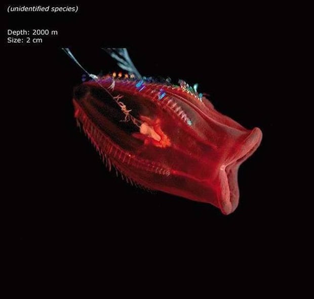
For marine science and popular culture alike, the Marianas are closely tied to the abyss. The nearby trench contains the Challenger Deep, the deepest known point in Earth’s oceans. That association often brings the islands into conversations about deep-sea life, submersible expeditions, and the physical limits of pressure, light, and habitability.
What do the islands look like in practice?
On the ground, the Mariana Islands are not a single landscape but a sequence of small tropical islands with volcanic cores, limestone terraces, coral reefs, and steep shorelines. Rainforest, scrub, and coastal vegetation shape the land, while reef systems and drop-offs define the surrounding waters. Human settlement concentrates where water, roads, and flat land allow it.
The archipelago is split politically. Guam, the southernmost and largest island, is a U.S. territory; the Commonwealth of the Northern Mariana Islands occupies much of the northern chain. That split affects everything from law and infrastructure to tourism and military presence. In daily life, the Marianas are places of local fisheries, imported goods, base towns, resort development, and deep cultural continuity.
Frequently Asked Questions
Are the Mariana Islands a country?
No. The islands are divided between U.S. territories rather than forming an independent country. Guam is an unincorporated U.S. territory, and the Northern Mariana Islands are a commonwealth in political union with the United States. Their people live under different local arrangements, but neither territory is sovereign in the way a nation-state is.
Why are the Mariana Islands linked to the deepest part of the ocean?
Because the Mariana Trench lies just east of the island arc. The islands themselves are the peaks of a volcanic system, while the trench marks a nearby subduction zone where one tectonic plate dives beneath another. The Challenger Deep, inside that trench, is the deepest known point in the global ocean.
Who originally lived there?
The Chamorro people are the Indigenous inhabitants of the Mariana Islands. Their culture, language, and seafaring traditions developed long before European contact. Colonial rule disrupted that history, but Chamorro identity remains central to the islands’ modern cultural life.
At a glance
- Address
- German New Guinea, United States
- Coordinates
- 16.7, 145.78
Articles mentioning Mariana Islands