
Maui is a Hawaiian island in the central Pacific, the second-largest of the Hawaiian Islands and the main island of Maui County. It is known for its volcanic landscapes, long coastal roads, rain-shadowed valleys, and a mix of resort development, agriculture, and Native Hawaiian cultural sites. As a place, Maui matters both as a living island community and as a setting for photography, environmental research, tourism, and land-based craft shaped by wind, salt, lava, and ocean light.
Stories from Maui
3 stories

About Maui
| Essential fact | Detail |
|---|---|
| Location | Central Pacific Ocean, part of the State of Hawaiʻi |
| Status | Island and county seat island within Maui County |
| Size | About 727.2 square miles |
| Major character | Volcanic ridges, dry leeward plains, wet eastern slopes, and deep coastal bays |
| Common uses in culture | Tourism, marine photography, astronomy, agriculture, conservation, and Native Hawaiian practice |
Read the full overviewWhat makes Maui distinct?, How is Maui made and used as a place?, Why do artists, photographers, and scientists work on Maui?, What should be understood about Maui as a living place?
What makes Maui distinct?
Maui’s geography gives it a sharp variety of conditions over a relatively small area. The massive shield volcanoes of Haleakalā and the older West Maui Mountains shape rainfall, cloud cover, and soil, creating lush windward forests on one side and dry scrub or pasture on the other. This contrast has long influenced how people build, farm, travel, and make images on the island.
The island’s roads and coastlines are as famous as its summit. The Road to Hāna, for example, became known for its tight curves, waterfalls, bridges, and dense vegetation, while the leeward coast near Wailea and Kā‘anapali is associated with beaches, hotels, and sunset views. These places are not just scenic backdrops; they are working landscapes where surf conditions, erosion, and access shape daily life.
How is Maui made and used as a place?
Maui was formed by volcanic activity above the Hawaiian hotspot, with lava flows building the island over millions of years. That geology still governs how the island looks and functions. Basalt rock, ash soils, steep drainage, and porous ground affect agriculture, water storage, and the placement of roads and buildings. The island’s built environment therefore reflects adaptation to a landscape made by fire and modified by ocean weather.
Historically, Native Hawaiian communities developed ahupuaʻa systems that organized land use from mountain to sea, linking forests, taro patches, fishing grounds, and settlements. Later plantation agriculture, especially sugar and pineapple, altered the island’s economy and land ownership patterns. Today, Maui’s economy depends heavily on tourism, but farming, conservation work, and scientific research still remain visible in the landscape.
Why do artists, photographers, and scientists work on Maui?
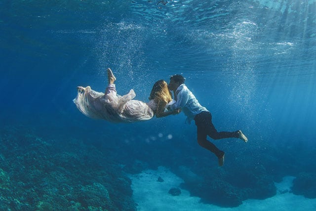
Maui offers unusually clear contrasts of scale, light, and texture. Sunrise above Haleakalā, trade-wind clouds over the central valley, black lava coastlines, and reef water with high visibility all create strong visual conditions. That is why the island appears often in photography, from landscape work to commercial shoots and underwater portraiture. Salt air, glare, and shifting weather also make it a demanding place to photograph well.
The island is also important to astronomy and environmental research. High elevations and relatively stable atmospheric conditions support telescopes and observatories, including facilities on Haleakalā. These projects depend on the island’s altitude, dry air, and wide horizons, though they also raise ongoing questions about land stewardship, access, and the protection of culturally significant sites.
What should be understood about Maui as a living place?
Maui is not just a resort destination. It is home to communities shaped by Native Hawaiian history, local labor traditions, immigrant plantation-era populations, and ongoing debates over housing, water, conservation, and tourism pressure. These tensions affect how land is used and who can remain on the island.
That context matters when Maui appears in visual culture. A beach image, a volcano panorama, or a telescope installation on the summit all sit inside a larger story about access, environmental change, and the making of place. Maui’s visual appeal comes from real work done to live with a fragile and powerful environment.
Frequently Asked Questions
Is Maui a city or an island?
Maui is an island, not a city. It is also the namesake of Maui County, which includes the islands of Maui, Molokaʻi, Lānaʻi, and unpopulated Kahoʻolawe. When people say “Maui,” they usually mean the island itself.
Why is Maui so often used in travel and photography?
Maui combines dramatic volcanic landforms, accessible beaches, and strong natural light. That makes it easy to frame visually, from aerial landscapes to underwater scenes. Its variety of climate zones in a compact area also gives photographers a lot to work with in a short distance.
What is Maui best known for besides tourism?
Maui is also known for astronomy, conservation, agriculture, and Native Hawaiian cultural sites. Haleakalā supports major scientific work, while the island’s waters and mountains remain central to environmental management and cultural practice. Those uses are often less visible than resorts, but they are fundamental to the island’s identity.