
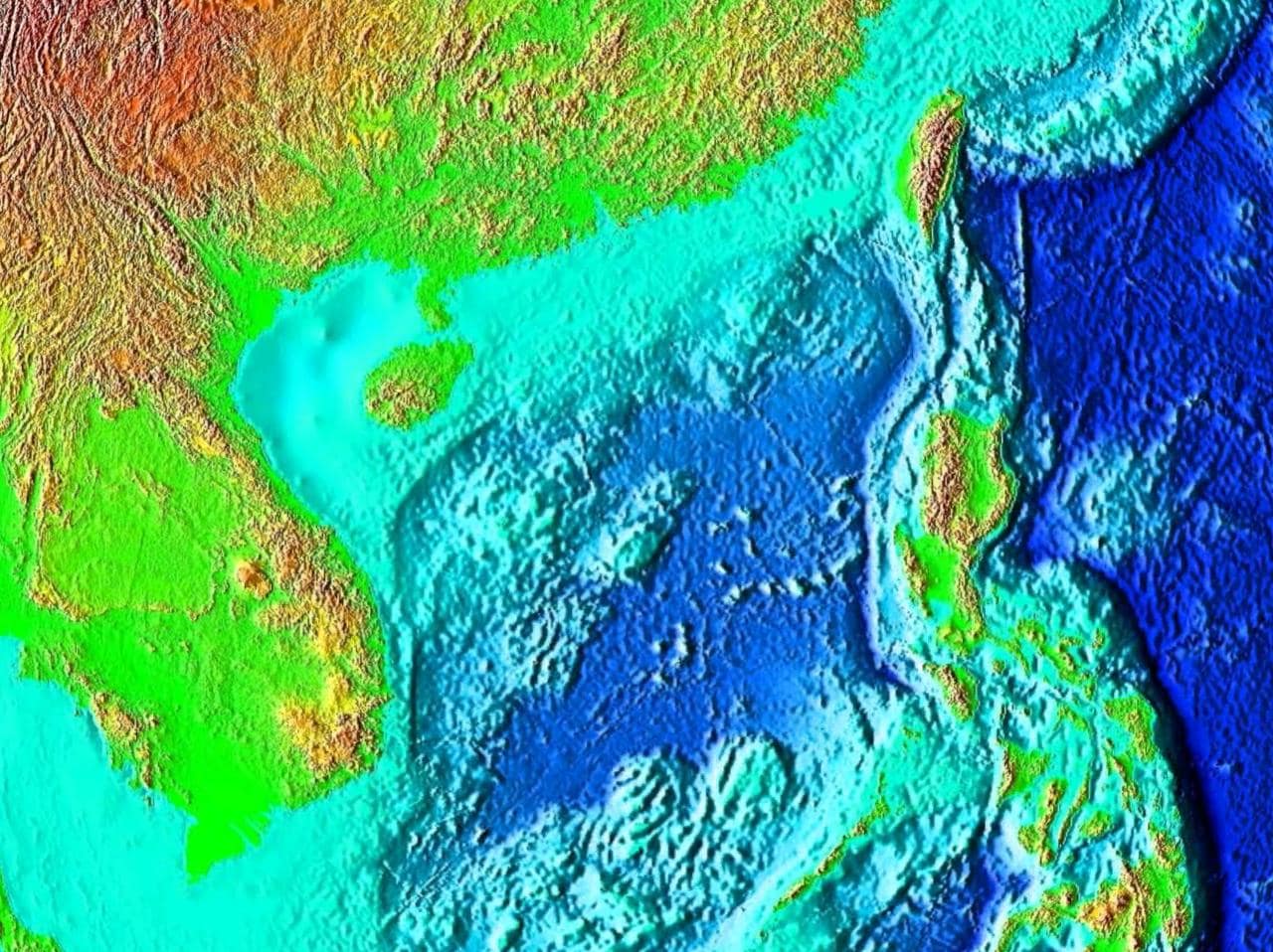
The South China Sea is a marginal sea of the western Pacific Ocean, bounded by mainland Southeast Asia, the Philippines, Borneo, Taiwan, and the southern coast of China. It stretches from the Singapore and Malacca straits in the southwest to the Taiwan Strait in the north, and it covers roughly 3.5 million square kilometres.
| Fact | Detail |
|---|---|
| Type | Marginal sea |
| Part of | Pacific Ocean |
| Approximate area | 3.5 million km² |
| Geographic span | Singapore and Malacca straits to the Taiwan Strait |
| Notable importance | Major shipping corridor; potential offshore oil and gas reserves |
Why it matters
The South China Sea matters because it sits on one of the busiest maritime routes on earth. A large share of global trade moves through its waters, linking East Asia to the Indian Ocean, the Middle East, and Europe through a chain of ports and straits. That traffic gives the sea strategic weight far beyond its coastline: it shapes shipping schedules, naval planning, insurance costs, and port design across the region.
It also matters as a resource frontier. Geological surveys suggest substantial oil and gas deposits beneath parts of the seabed, which has made the sea a focus of competing claims and intense state attention. For coastal cities and infrastructure planners, the sea is not an abstract expanse but a working environment that influences reclamation, harbours, airport siting, and shoreline engineering.
What does the South China Sea look like in practice?
The sea is not uniform open water. It contains broad shipping lanes, shallow banks, coral reefs, island groups, fishing grounds, and busy coastal approaches near places such as Hong Kong, Vietnam, the Philippines, and Singapore. In practical terms, this means changing water conditions, dense vessel traffic, monsoon weather, and constant negotiation between commerce, ecology, and sovereignty.
For designers, architects, and visual storytellers, the South China Sea appears as a system rather than a single landscape. It frames port skylines, container terminals, fishing fleets, airport runways near reclaimed shorelines, and the long-distance movement of goods and materials. It also shapes local craft and maritime culture, from traditional boats to contemporary images of coastlines under pressure from development and climate change.
How did it become so important?
Its importance comes from geography. The sea connects the Pacific and Indian Ocean worlds through narrow chokepoints, especially the Malacca Strait, one of the most heavily used shipping corridors globally. That position has made the area central to trade for centuries and central to modern geopolitics since industrial shipping expanded across Asia.
It also sits atop a contested seabed and a contested map. Multiple countries claim parts of the sea and its islands, reefs, and waters, so the region is never just a natural feature. It is also a legal and political space, shaped by maritime boundaries, patrols, fishing rights, and infrastructure decisions that affect how the water is used and represented.
Why does it appear in design, art, and travel coverage?
The South China Sea often appears in writing about cities and objects because it links local scenes to global circulation. A waterfront project in Hong Kong, for example, makes more sense when set against the sea lanes and harbour culture that gave the city its shape. An airport built on a coast facing the South China Sea is part of the same logistical world, tied to freight, tourism, and regional mobility.
Artists and photographers are drawn to it because it combines scale with visible pressure. Newborn whales, cargo fleets, fishing boats, waterfront skylines, and disputed islets can all sit within one frame of reference. That mix of beauty, commerce, and conflict gives the sea a strong visual presence and makes it a recurring subject in contemporary design and editorial work.
Frequently Asked Questions
Is the South China Sea the same as the Pacific Ocean?
No. It is part of the Pacific Ocean, but more specifically a marginal sea along its western edge. The term marks a defined regional body of water with its own geography, ecology, shipping routes, and political disputes.
Why is the South China Sea often mentioned in news reports?
It appears in news because it combines heavy trade, territorial disputes, military patrols, and resource claims. Any disruption there can affect shipping and diplomacy across Asia and beyond. That makes it a place where geography quickly turns into international politics.
What makes the sea important to cities and infrastructure?
Its coastline supports major ports, airports, and reclaimed land projects, especially in densely built coastal regions. Designers and engineers work with tides, storms, shipping access, and unstable shorelines at the same time. The sea therefore shapes both the look of a city and the way it functions.