
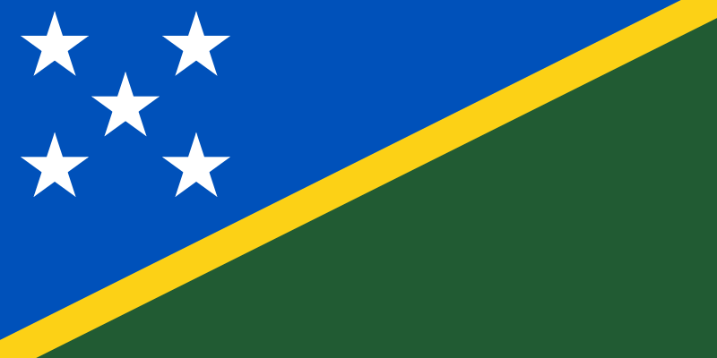
The Solomon Islands are a sovereign island country in Melanesia, made up of nearly 1,000 islands east of Papua New Guinea. Their largest settlement and capital is Honiara, on Guadalcanal, and the country covers about 28,400 square kilometres of land. Long inhabited by Indigenous Melanesian peoples, the islands entered European records in 1568, when the Spanish navigator Álvaro de Mendaña named them Islas Salomón.
- An island nation in the southwest Pacific, within Melanesia.
- Made up of many islands, with Guadalcanal the best-known and most populous.
- Honiara is the capital and principal administrative centre.
- People have lived there for thousands of years, shaping distinct local cultures and languages.
- European contact began in the 16th century, but the islands remained central to Pacific regional histories rather than a European settlement project.
Where are the Solomon Islands?
The Solomon Islands sit to the east of Papua New Guinea and north-east of Australia, spread across a broad arc of volcanic and raised coral islands. The country’s geography matters because it is not a single landmass but a dispersed archipelago, with communities linked by sea routes, small aircraft, and inter-island shipping. That shape affects everyday life, trade, access to services, and the visual character of the country: water, forest, reef, and mountain are rarely far apart.
Guadalcanal, Malaita, Choiseul, Santa Isabel, and New Georgia are among the best-known islands. Some are high and densely forested; others are low coral islands or atolls. The result is a country of strong local variation, where climate, coastline, and terrain change quickly over short distances.
What do the Solomon Islands look like on the ground?
The physical landscape is dominated by tropical vegetation, steep interiors, mangroves, lagoons, and reef systems. Coastal settlements often cluster around sheltered bays or river mouths, where boats can land and communities can access fishing grounds. Inland, dense forest and rugged slopes have historically limited large-scale road networks, so movement often remains tied to the shoreline and sea.
This geography has shaped building and material culture. Timber, thatch, fibre, shell, and coral have long been common materials in local construction and craft, while imported corrugated metal and concrete now appear widely in towns and villages. Houses range from traditional open-sided structures to more enclosed modern dwellings, but many still respond directly to heat, rain, and humidity with raised floors, ventilation, and deep eaves.
Why do the Solomon Islands matter historically?
The islands were inhabited for millennia before European arrival, and their history belongs first to Pacific migration, settlement, and exchange. Archaeology and oral tradition show long-standing networks of movement between islands, with distinct languages, kinship systems, and local forms of authority developing over time. This precolonial depth matters because it places the Solomon Islands within a living Pacific history rather than as a place defined only by outside contact.
European interest grew after Mendaña’s 1568 voyage, followed later by missionaries, traders, and colonial administrators. British rule and the wider plantation economy left lasting effects on land use, labour, religion, and governance. During the Second World War, Guadalcanal became a major theatre of conflict, and that history still shapes place memory and international recognition of the islands.
What role do the Solomon Islands play today?
Today the Solomon Islands are known for fisheries, forestry, subsistence agriculture, and public administration concentrated in Honiara. The country’s economy and infrastructure remain closely tied to maritime transport and climate conditions. Cyclones, heavy rainfall, coastal erosion, and changing ocean temperatures all have direct consequences for settlements, food systems, and supply chains.
For visual culture, the islands matter because they condense many of the Pacific’s defining themes into one place: archipelagic space, intense colour and weather, dense ecological life, and a built environment that mixes ancestral techniques with imported materials. In photography, film, and design, the Solomon Islands often appear through their seascapes and forests, but their deeper significance lies in the long continuity of island life and the practical forms people have made to live there.
Frequently Asked Questions
Are the Solomon Islands a single island?
No. The Solomon Islands are an archipelago, not one island, and the country includes nearly 1,000 islands of different sizes and types. Some are large, mountainous islands such as Guadalcanal, while others are small coral islands or atolls.
What language is spoken in the Solomon Islands?
English is the official language, but Solomon Islands Pijin is widely used in everyday communication. In addition, the country has many Indigenous languages, reflecting the cultural and linguistic diversity of the islands. Local language use remains an important part of identity and community life.
Why is Guadalcanal so well known?
Guadalcanal is the site of Honiara, the capital, and it was also a major battlefield during the Second World War. That combination of political centrality and wartime history has made it the best-known island in the country outside the region. It is also one of the largest and most geographically significant islands in the archipelago.
At a glance
- Address
- Solomon Islands
- Coordinates
- -9.466666, 159.81667
Articles mentioning Solomon Islands
