
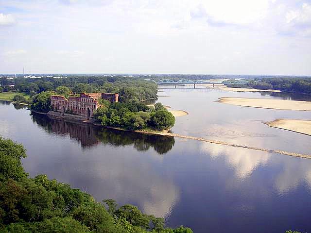
The Vistula is Poland’s longest river and the country’s central waterway, running from the Silesian Beskids in the south to the Baltic Sea at Gdańsk. It is 1,047 kilometres long and drains a basin that covers much of Poland, which makes it one of the most important geographic lines in the nation’s landscape, economy, and visual identity.
- Length: 1,047 km
- Source: Barania Góra in the Silesian Beskids
- Mouth: Gdańsk Bay on the Baltic Sea
- Main role: drainage, transport corridor, urban edge, and national boundary in the imagination of Poland
- Notable fact: it divides Poland roughly into western and eastern halves
Where does the Vistula begin and end?
The Vistula rises on the slopes of Barania Góra, where the White Little Vistula and Black Little Vistula join in the mountain terrain of southern Poland. From there it moves northward through a long chain of plains, towns, and historic cities before reaching the Baltic. Its course passes Kraków, Warsaw, Płock, Toruń, and Gdańsk, linking upland headwaters to a lowland delta and sea outlet.
That long northbound route matters because the river collects water from a very large watershed, most of it inside Poland. The Vistula basin shapes floodplains, soils, settlement patterns, and transport corridors across the country. It also gives the river a clear visual character: broad bends, seasonal ice, flat banks, levees, and, near cities, engineered embankments and bridges.
Why does the Vistula matter in Poland?
The river has long acted as a structural axis for Poland. Towns grew on its banks because the river offered fresh water, access to trade, and a route through the interior. In earlier periods, grain, timber, and other cargo moved downriver toward the Baltic ports, tying the river to the export economy of the Polish–Lithuanian Commonwealth and later industrial Poland.
It also matters symbolically. The Vistula appears in Polish literature, painting, cartography, and political language as a national river, not just a geographic feature. Because it runs through the capital, Warsaw, it frames the city’s plan and image: bridges crossing a wide channel, winter ice, floodbanks, and open riverfronts visible from high viewpoints or aerial photographs.
What does the Vistula look like in practice?
The river changes character along its length. In the south it begins as fast mountain streams. Farther north it becomes a wide lowland river with sandbars, meanders, backwaters, and floodplain vegetation. In city sections such as Warsaw, its scale can feel surprising: the river bed is broad, and the built city sits back from the banks in places, leaving room for seasonal variation and open views.
That physical form influences how artists and photographers represent it. Winter images often emphasize the Vistula’s pale surface, dark channel, ice floes, and the graphic contrast between water, snow, and the city edge. In aerial views, the river reads as a long, dark ribbon cutting through an urban field, with bridges and embankments acting as strong linear marks.
How has the river been shaped by engineering?
Like many major European rivers, the Vistula has been altered by dredging, embankments, flood control works, and port infrastructure. These interventions aim to manage floods, stabilize banks, and keep sections navigable. They also change the river’s appearance, replacing marshy edges and shifting channels with straighter, harder lines in urban and industrial stretches.
Even with these changes, the river remains dynamic. Floods, sediment movement, ice, and seasonal water levels continue to reshape its margins. That mix of control and change is part of what makes the Vistula visually compelling: it is both a managed infrastructure corridor and a living river with visible seasonal variation.
Frequently Asked Questions
Is the Vistula navigable?
Parts of the Vistula can be used by boats, but it is not a uniformly reliable navigation route. Water depth, sandbars, seasonal changes, and engineering constraints limit continuous traffic along the full length. Historically it served trade well in sections, especially when cargo moved downstream toward the Baltic.
Why is Warsaw so closely associated with the Vistula?
Warsaw sits on the river’s banks, and the Vistula gives the city a distinctive open landscape within a dense capital. It creates a strong visual divide between left and right bank, while also linking them through bridges and ferry crossings. In photography, the river often provides the widest and most legible natural element in the city.
Does the Vistula have cultural importance beyond geography?
Yes. The river appears in national history, regional identity, and everyday urban life, especially in cities along its course. It has been treated as a symbol of continuity, movement, and Polish territory itself, which is why it often appears in art and documentary photography as more than a background feature.