
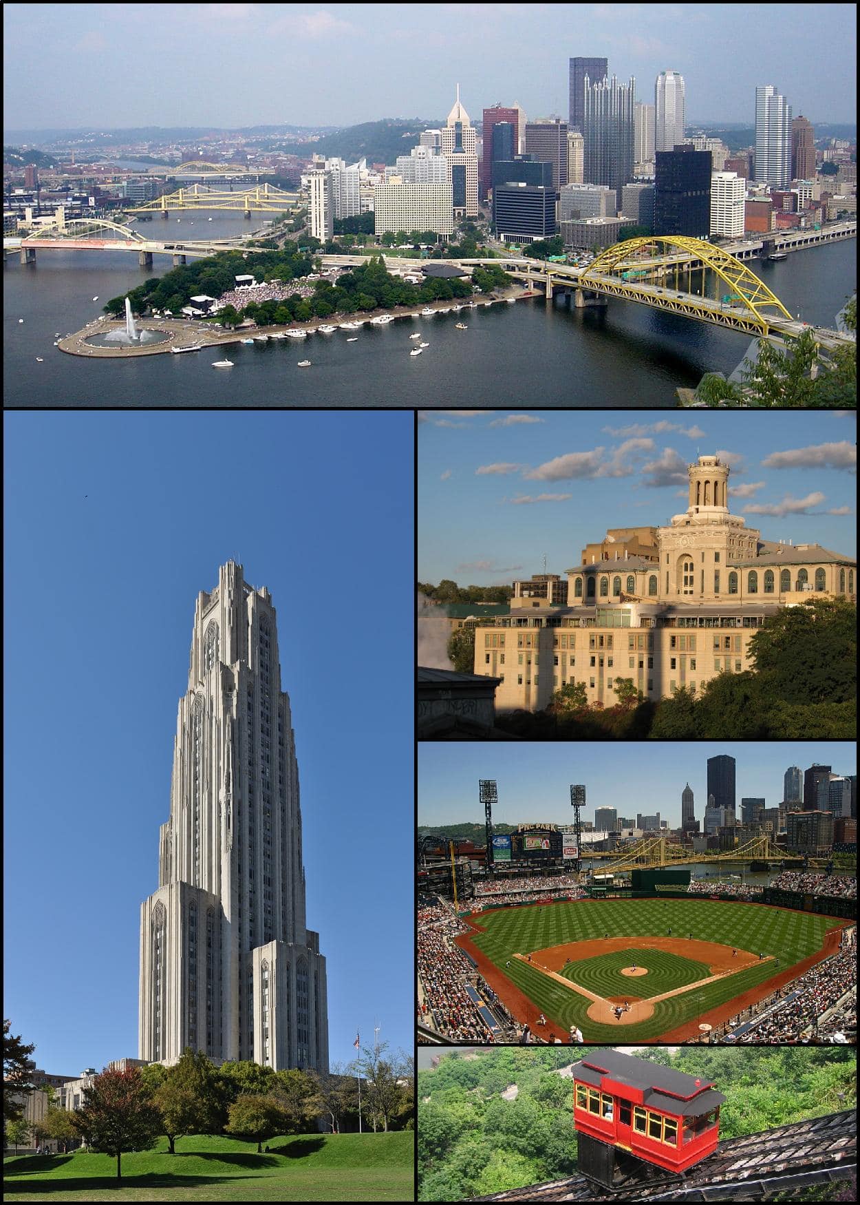
Pittsburgh is a city in western Pennsylvania, at the meeting point of the Allegheny, Monongahela, and Ohio rivers. It grew from a frontier fort and river port into one of the United States’ most important industrial cities, and it remains a major center for medicine, higher education, robotics, and design-led public art. Its built form, bridges, and steep slopes give it a distinct visual character that artists and photographers often use as a subject in their own right.
- Known historically for steelmaking, river commerce, and heavy industry.
- Nicknamed the Steel City and the City of Bridges.
- Has an unusually compressed landscape of hills, rivers, viaducts, and retaining walls.
- Today it is also associated with universities, hospitals, tech firms, and civic art projects.
- Its street grids, bridge spans, and painted surfaces make it a strong site for murals and public interventions.
Why Pittsburgh became important
Pittsburgh’s location explains much of its history. The city sits where river routes converge, which made it useful first for trade and military control, then for industry that depended on water transport and coal. During the 19th and 20th centuries, steel mills, foundries, glassworks, and machine shops turned the city into a manufacturing powerhouse. That industrial base shaped everything from labor politics to the soot-darkened appearance that once defined the skyline.
As steel declined in the late 20th century, Pittsburgh did not disappear. The city rebuilt around health care, universities, finance, and research, while retaining the material memory of its industrial period in bridges, warehouses, and riverfront infrastructure. That mix of old and new gives the city an unusual visual tension: a former factory city that now hosts contemporary art, public design, and experiments in urban reuse.
What does Pittsburgh look like?
Pittsburgh is not a flat grid city. It is steep, folded, and layered, with neighborhoods perched on hillsides and roads that change level quickly. The rivers cut the city into sharp sections, and bridges connect those pieces in ways that are both practical and visually dramatic. The landscape produces strong diagonals, long views, and sudden transitions between dense built fabric and open water.
That geometry matters to visual culture. Murals, billboards, and public artworks often read differently here because they are set against retaining walls, bridge abutments, warehouse façades, and sloping streets rather than blank downtown plazas. In practice, Pittsburgh tends to reward work that can hold its own against a busy, industrial background: bold color, large scale, and simple forms tend to survive better than delicate detail.
How did the city become a site for public art?
Pittsburgh has a long relationship with civic image-making. Like many industrial cities, it used public works to soften the impact of heavy infrastructure and to remake districts after deindustrialization. Murals, sculpture, and temporary installations now appear in neighborhoods, near sports facilities, on court surfaces, and along commercial corridors. These works often turn overlooked infrastructure into a visible part of the city’s identity.
That makes Pittsburgh useful to artists working with site-specific imagery. A mural on a pickleball court, for example, is not just decoration; it changes how the ground is read and how movement is organized across space. The city’s paved, segmented, bridge-linked layout encourages that kind of intervention, where art functions as wayfinding, civic branding, and public gesture at once.
Why does Pittsburgh matter in visual culture?
Pittsburgh matters because it offers a clear example of industrial history being repurposed rather than erased. The city’s bridges, river edges, and factory remnants still structure how it is seen, even as new institutions and cultural projects redefine it. For photographers and artists, that creates a setting where labor history and contemporary urban life remain visible in the same frame.
It also matters as a place where material contrast is easy to see. Steel, concrete, painted court surfaces, brick, and river water sit close together. That closeness gives Pittsburgh a strong tactile identity, which is why it often appears in work that cares about surfaces, civic space, and the ordinary built environment.
Frequently Asked Questions
Why is Pittsburgh called the Steel City?
Pittsburgh earned that name because steelmaking drove its economy for decades. The region’s coal, rail, and river access supported mills and related industries that supplied steel across the country. The nickname still signals the city’s industrial past, even though heavy manufacturing no longer defines it in the same way.
Why is Pittsburgh called the City of Bridges?
Pittsburgh has an unusually large number of bridges because its rivers, valleys, and hills divide the city into many separate sections. Bridges are not just landmarks there; they are part of everyday movement and city planning. The nickname reflects both the quantity of crossings and their role in shaping the city’s visual identity.
What kinds of creative work are associated with Pittsburgh today?
The city is associated with public art, murals, design-forward civic projects, and work that responds to urban infrastructure. It also has strong ties to photography, higher education, and contemporary installation practices. Many artists use Pittsburgh as a setting where industrial surfaces and neighborhood life can be brought into the same image.
At a glance
- Address
- Allegheny County, United States
- Coordinates
- 40.638798, -80.51899
Articles mentioning Pittsburgh


