
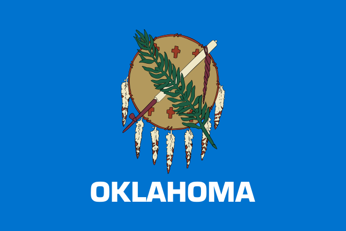
Oklahoma is a state in the south-central United States, admitted to the Union in 1907 after the joining of Oklahoma Territory and Indian Territory. Its name comes from the Choctaw words okla and humma, meaning “red people.” In visual culture, Oklahoma often appears less as a single style than as a place where Indigenous history, ranching, weather, and oil wealth have shaped the built environment, craft traditions, and public imagery.
- Statehood came late, in 1907, after a long period of territorial settlement and forced Indigenous displacement.
- The name is Choctaw, not English, and points to the state’s Native linguistic roots.
- Oklahoma’s visual identity is strongly shaped by severe weather, open land, and frontier-era architecture.
- Craft, folk, and public art in the state often draw on Native, agricultural, and Western references.
- Its nickname, “The Sooner State,” comes from the contested opening of lands to settlers before statehood.
How did Oklahoma become a state?
Oklahoma became the 46th state on 16 November 1907, when Oklahoma Territory and Indian Territory were merged. That timing matters because the state emerged from overlapping systems of U.S. expansion: land runs, reservation boundaries, rail lines, and federal policy all left marks on its geography and institutions. The state’s formation is inseparable from the relocation and administration of Native nations, which means Oklahoma’s history is not just frontier settlement but also a record of displacement, adaptation, and survival.
That history still shapes the way the state is read visually. Courthouses, main streets, county fairs, and roadside structures often sit beside tribal government buildings, mission schools, and oil infrastructure. The result is a landscape where older Indigenous presence and later settler imagery coexist rather than replace one another.
What does Oklahoma look like?
Oklahoma spans prairie, plains, red-earth hills, and storm-prone sky, so its visual character is often defined by scale and exposure. Long horizons, sparse tree cover in many regions, and repeated weather systems make the land itself highly legible. That is one reason photographers and painters are drawn to the state: clouds, dust, tornado structures, and low light become part of the composition rather than background.
The built environment tends to reflect agriculture, oil extraction, transport, and small-town commerce. Barns, grain elevators, pump jacks, brick storefronts, gas stations, and weather vanes belong to the same visual field. In craft and design, these forms can become motifs, especially when makers work with reclaimed wood, metal, enamel, textile, or ceramic surfaces that carry the marks of use.
Why does Oklahoma matter in art and design?
Oklahoma matters because it sits at the intersection of Native cultures, rural labor, and a strong tradition of regional imagery. Artists working there often engage with memory, land, and public history rather than pure abstraction. That can mean painted plates, stitched textiles, wood assemblages, or documentary photography that treats local life as material for visual form.
The state also appears in work that records weather with precision. Black-and-white storm photography, for example, uses contrast, motion, and distance to turn severe weather into structure. The same is true in object-based work that borrows from the look of ranch tools, weathervanes, or utilitarian signage: function becomes style, and style remains tied to place.
What does “The Sooner State” mean?
“The Sooner State” refers to the people who entered land in the Oklahoma Territory before the official opening, especially during the land runs of the late 19th century. The term carries a celebratory tone in state branding, but it also points to competition over land and the uneven rules used to distribute it. That history sits behind many of the state’s public symbols and narratives of settlement.
In practice, the nickname shows up in sports, advertising, and local iconography, where speed, readiness, and opportunism are treated as part of the state’s identity. For a visual culture reader, that matters because names are never neutral: they frame how objects, posters, mascots, and commemorative graphics present the state to itself and to outsiders.
Frequently Asked Questions
Is Oklahoma considered part of the South, the Midwest, or the Southwest?
Oklahoma is usually placed in the south-central United States, and depending on the context it may be grouped with the South, the Midwest, or the Southwest. That ambiguity reflects climate, settlement patterns, and cultural overlap rather than confusion. In design and art writing, the label often shifts with the subject: ranching imagery pulls one way, prairie landscape another, and Indigenous geography another.
Why is Oklahoma important to Native American history?
Oklahoma became home to many Native nations through forced removal, treaty violations, and later federal land policy. After statehood, tribal communities continued to build governments, schools, art practices, and cultural institutions within the state. Any serious account of Oklahoma has to include those histories, because they shape the land, the population, and the visual record.
What kinds of imagery are most associated with Oklahoma?
Storm clouds, open plains, oil pumps, wheat fields, rodeo culture, and small-town streets are among the most familiar images. But those shorthand views only cover part of the state’s visual life. Native craft, contemporary art, and urban design in places like Oklahoma City and Tulsa offer a much wider range of forms and references.