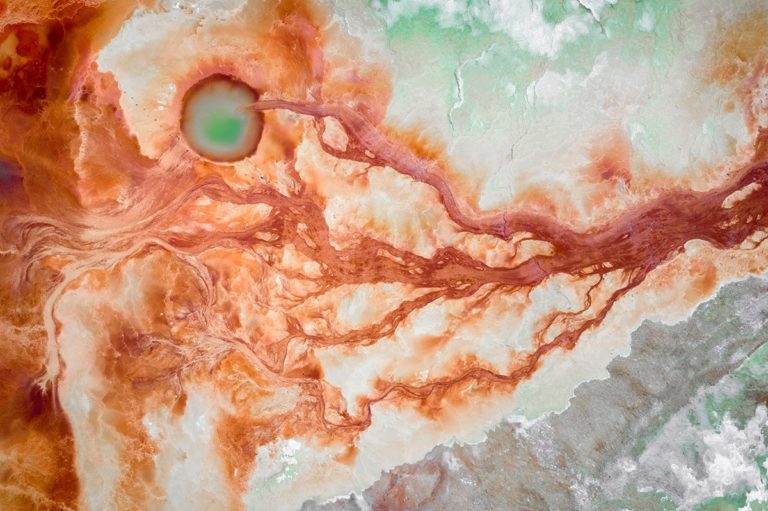
The Gobi Desert is a vast cold desert region in East and Central Asia, spanning southern Mongolia and northern China. It is one of the world’s great desert landscapes, defined less by dunes than by arid basins, rocky plains, gravel flats, and sparse grassland at its margins.
- It lies across southern Mongolia and northern China, with basins framed by the Altai Mountains, the Mongolian steppe, the Hexi Corridor, the Tibetan Plateau, and the North China Plain.
- The Gobi is a cold desert, with severe winters and large temperature swings, unlike the hot sand deserts that dominate the popular imagination.
- Its terrain is varied: stone deserts, salt pans, dry valleys, and occasional dune fields appear alongside steppe and scrub.
- It mattered historically as a route zone for the Silk Road and as part of the Mongol Empire’s core territory.
- Today it is known for extreme weather, thin settlement, fossil beds, and stark, high-contrast landscapes that attract photographers and travelers.
What makes the Gobi different from other deserts?
The Gobi is not a single seamless sea of sand. Much of it is made up of bare rock, gravel, clay, and wind-scoured flats, with sand dunes concentrated in smaller areas. This gives the landscape a harder, more angular appearance than desert regions built mainly from eroded sand.
Its climate sets it apart as well. The Gobi is a cold desert, so winter temperatures can fall sharply below freezing, while summer heat can still be severe. Rainfall is low, but not absent, and the region’s ecology depends on brief seasonal bursts of moisture that support grasses, shrubs, and hardy desert animals.
Where is the Gobi Desert?
The Gobi stretches across a huge sweep of territory in northern and northwestern China and southern Mongolia. Its edges are not a single line but a broad transition zone, where mountains, steppe, and dry uplands meet the desert basins. The Altai Mountains, the Mongolian grasslands, the Hexi Corridor, and the Tibetan Plateau all shape its boundaries and climate.
Because the region is so large, “the Gobi” refers to a family of landscapes rather than one uniform place. Some areas are better known for rock and gravel, others for salt basins, dry lake beds, or dune fields. This variety matters visually: it means the Gobi can read as austere, metallic, and almost lunar in one place, then open and pastoral in another.
Why does the Gobi matter historically?
The Gobi mattered because it sat inside a major corridor of movement across Eurasia. Caravan routes connected oasis towns and trading centers around and through the desert, linking China, Mongolia, Central Asia, and beyond. In this sense, the Gobi was not an empty void but a difficult passage lined with settlements, wells, and waypoints.
It also formed part of the political and military landscape of the Mongol Empire. Mongol power emerged from steppe societies that moved through and beyond this region, using its expanses as both homeland and strategic space. That history still colors how the Gobi is imagined: as a place of mobility, distance, and survival rather than fixed borders.
What does the Gobi look like in practice?
On the ground, the Gobi often appears as a field of muted tones: gray stone, ochre dust, pale salt, and a washed-out sky. Vegetation is sparse and low, so the horizon tends to feel exposed and uninterrupted. In some basins, erosion and mineral deposits create surfaces that look almost industrial, while in others the land opens into wide, quiet expanses punctuated by camels, small settlements, or ruined caravan sites.
For photographers, filmmakers, and designers of place imagery, the Gobi offers strong visual contrasts without a lot of clutter. Its appeal lies in scale, emptiness, and texture: cracked earth, wind-carved ridges, distant mountains, and light that changes quickly across bare ground. That starkness helps explain why the desert appears so often in travel writing and landscape photography.
Frequently Asked Questions
Is the Gobi Desert mostly sand?
No. Large parts of the Gobi are rocky or gravelly, and many areas look more like dry steppe or stony upland than the classic image of dunes. Sand dunes do exist there, but they are only one part of a much broader desert system.
Why is the Gobi called a cold desert?
The term refers to temperature, not appearance. The Gobi gets very hot in summer, but it also experiences long, severe winters with freezing conditions and strong winds. Low precipitation combined with extreme seasonal swings makes it a cold desert.
Why do artists and photographers return to the Gobi?
The Gobi offers a landscape of large forms and few distractions, which makes texture, light, and distance easier to see. Its muted palette and severe weather create images that feel pared back and graphic. That clarity suits photography that relies on atmosphere, scale, and surface detail.
At a glance
- Address
- People's Republic of China
- Coordinates
- 48, 107
Articles mentioning Gobi Desert