
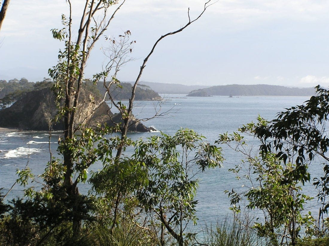
South Coast (New South Wales) is the coastal strip of south-eastern New South Wales that runs from the southern edge of the Sydney region down to the Victorian border. It is not a single city or administrative district, but a broad geographic region shaped by beaches, headlands, estuaries, bushland and the escarpment that rises to the west.
| Type | Geographic region |
|---|---|
| Location | South-eastern New South Wales, Australia |
| Extent | From the Sydney fringe to the Victorian border |
| Landscape | Coastline, bays, river mouths, coastal forests, national parks |
| Notable protected areas | Jervis Bay National Park, Eurobodalla National Park, Ben Boyd National Park |
Where is the South Coast?
The South Coast follows the Pacific edge of New South Wales, with the sea on one side and the coastal escarpment and Southern Tablelands on the other. It includes well-known stretches around Jervis Bay, Batemans Bay, Moruya, Narooma, Merimbula and Eden, as well as smaller towns and surf beaches between them. The region has a long, irregular shoreline rather than a single continuous urban front.
Its western boundary is defined more by landform than by a strict line on a map. The escarpment marks the point where the coastal plain gives way to higher country, and much of that hinterland is preserved in national parks and reserves. That mixture of sea, forest and cliff country gives the region a strongly varied visual character.
Why does it matter in Australian visual culture?
The South Coast matters because it offers a dense concentration of coastal forms that artists and photographers return to again and again: breaking surf, rock shelves, sea caves, headlands, long beaches and weathered bushland. Light changes quickly here, and the same shoreline can shift from glassy calm to storm-driven violence within hours. For landscape makers, that volatility creates images with strong movement and texture.
It also matters as a working landscape rather than only a scenic one. Fishing, tourism, conservation, small-scale agriculture and coastal settlement all shape the built and natural environment. Those layers affect what appears in photographs and paintings: boats pulled onto sand, breakwalls, oyster leases, holiday houses, caravan parks, wet forests and the infrastructure needed to live with the sea.
What does it look like in practice?
In practice, the South Coast is defined by contrasts. A beach may sit next to a sheltered estuary; a surf break may be framed by basalt headlands; a national park may begin just behind a subdivision. The region often reads as spacious and open, but many of its most recognisable scenes are compressed compositions where ocean, rock and sky crowd into a narrow horizontal band.
For makers working there, the coastline offers repeating visual motifs: foam lines, tidal pools, sand patterns, spray clouds and the dark forms of rock ledges under changing weather. Warren Keelan’s wave photography, for example, draws on this exact setting, using the South Coast’s heavy surf and clean coastal light to turn familiar water movement into highly detailed, near-abstract images.
How is it different from nearby coastal regions?
The South Coast is often compared with the Northern Rivers, Central Coast or Illawarra, but its scale and character are distinct. It is less urban than the coastline around Sydney, and in many stretches settlement thins quickly once the main towns are left behind. That relative openness leaves larger uninterrupted views of sea and forest.
It also has a cooler, more temperate feel than much of eastern Australia’s subtropical coast. Storm fronts, winter swells and rugged headlands are part of its visual identity. The result is a region associated as much with dramatic weather and exposed geology as with leisure and beach culture.
Frequently Asked Questions
Is the South Coast an official administrative region?
It is mainly a geographic and cultural region, not a single formal government area. Different agencies may define its boundaries slightly differently depending on the context. In everyday use, the term usually refers to the NSW shoreline south of Sydney and north of Victoria.
What kinds of landscapes define the South Coast?
The region combines beaches, surf breaks, rocky headlands, estuaries, coastal forests and an inland escarpment. National parks protect many of the most intact sections, especially where cliffs and bushland meet the sea. That variety is a major reason the area is so visible in landscape photography.
Why do artists and photographers keep returning to it?
The South Coast offers strong natural structure: clear horizons, repeating wave forms, dark rock against pale water and rapidly changing weather. Those elements produce images with texture and movement, especially in black-and-white or high-contrast colour work. The coastline can feel familiar at first glance, but it rewards close observation.
Articles mentioning South Coast (New South Wales)
