
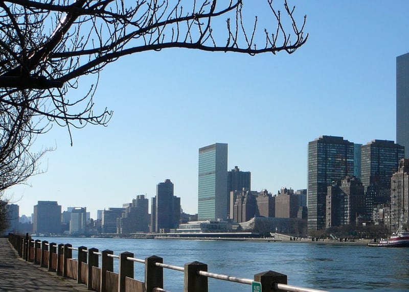
The East River is a tidal strait in New York City that runs between Manhattan and the Bronx on one side and Long Island on the other. It links Upper New York Bay to Long Island Sound, and its current reverses with the tide rather than flowing in one fixed direction. Though called a river, it behaves more like a moving saltwater channel, shaped by the Atlantic tide and the city built along its edges.
| Type | Tidal strait |
|---|---|
| Location | New York City, New York |
| Connects | Upper New York Bay and Long Island Sound |
| Borders | Manhattan, the Bronx, and Long Island |
| Also called | Sound River |
Why is it called a river if it is tidal?
The name comes from older habits of description, not from hydrology. Early settlers and mapmakers often used “river” for any significant waterway, even when tides dominated its movement. The East River is saltwater and highly tidal, so it is more accurately described as a strait or channel than a river.
Its tidal character made it important for shipping, ferries, and later bridge construction. The water level and current changed throughout the day, and that affected where boats could travel, where docks could sit, and how the shoreline was used. In a dense city, that kind of waterway becomes part of infrastructure, not just scenery.
How does the East River behave?
The East River usually reverses direction four times a day as the tide rises and falls. That shift can create strong currents, especially in narrow passages such as Hell Gate, where the river meets Long Island Sound and the flow accelerates. For centuries, those currents mattered to sailors, pilots, and anyone trying to move goods along the waterfront.
Because the water is tidal, the shoreline has always been unstable in practical terms. Piers, landings, and filled land have repeatedly changed the edge of the river. The modern waterfront is therefore a man-made arrangement sitting on top of a much older, moving estuary system.
What made the East River important to New York?
The East River has long been one of New York’s working waterways. Before bridges and tunnels, ferries crossed it constantly, carrying people, livestock, freight, and raw materials between boroughs. That made the river central to trade and daily life, even though it also acted as a barrier between neighborhoods and jurisdictions.
Its banks became sites of industry, warehouses, shipyards, and later highways and residential redevelopment. The river helped organize the city’s geometry: Manhattan stretched north-south along one edge, while Brooklyn and Queens developed across from it. The waterway also shaped civic imagination, because so much of New York’s growth depended on overcoming or using it.
What does the East River look like in practice?
In practice, the East River is not a broad, placid river but a busy strip of water bordered by hard edges: bulkheads, seawalls, piers, bridges, and dense urban fabric. The Brooklyn Bridge, Manhattan Bridge, Williamsburg Bridge, and Queensboro Bridge all span it, turning the water below into a framed corridor rather than an open channel. From nearby streets, it reads as part industrial edge, part civic stage.
Its surface changes constantly. Wind, tide, and traffic combine to make it look slate-gray, brown, or steel-blue depending on weather and light. At slack tide it can seem almost still; at other moments it carries visible shear and eddies. That variability is one reason artists, photographers, and urban planners return to it as a subject.
Frequently Asked Questions
Is the East River actually a river?
Not in the strict geographic sense. It is a tidal strait, which means it is a saltwater channel driven by the tide rather than a freshwater river flowing from source to sea. The name survived from older usage and from New York’s long habit of treating major waterways as “rivers” regardless of type.
Why does the current reverse?
The current reverses because the East River is tied to two larger bodies of water and responds to the tidal pulse moving through them. As water rises and falls on either side, the flow shifts direction. In effect, the river is pulled back and forth by the tide multiple times each day.
What is the East River best known for?
It is best known for separating Manhattan from Brooklyn and Queens, for its many bridges, and for its role in the city’s maritime past. It also stands out because its strong tides and currents make it unlike the quieter, more familiar image of a river. In New York, it functions as both a transport corridor and a defining urban boundary.
At a glance
- Address
- New York City, United States
- Coordinates
- 40.786944, -73.9175
Articles mentioning East River
