
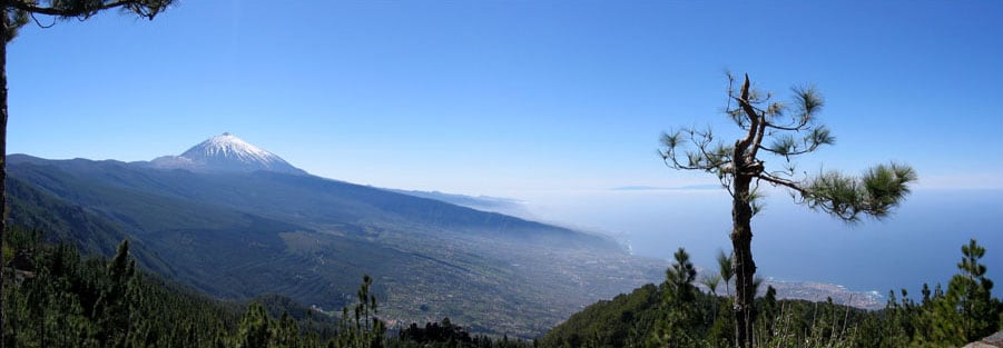
The Canary Islands are a Spanish archipelago in the Atlantic Ocean off the northwest coast of Africa, made up of seven main islands and several smaller ones. They form one of Spain’s autonomous communities and an outermost region of the European Union. Their volcanic landforms, dry light, and varied climates have made the islands important for agriculture, tourism, astronomy, and photography.
| Fact | Detail |
|---|---|
| Location | Atlantic Ocean, off Morocco and Western Sahara |
| Political status | Autonomous community of Spain |
| EU status | Outermost region of the European Union |
| Main islands | Tenerife, Fuerteventura, Gran Canaria, Lanzarote, La Palma, La Gomera, El Hierro |
| Landscape | Volcanic peaks, lava fields, cliffs, black-sand beaches, and cloud forests |
What makes the Canary Islands distinct?
The islands sit close to Africa but belong politically to Spain, which gives them a layered identity shaped by Iberian, Atlantic, and North African histories. Their position in the trade winds creates sharp changes in weather over short distances: one slope may be humid and green while another nearby is dry and bright. That contrast is one reason the archipelago supports such different visual environments in a relatively small area.
Volcanism defines the islands’ physical character. Lava flows, cones, calderas, and basalt cliffs dominate the terrain, especially on Tenerife, Lanzarote, and La Palma. Soil, rock, and elevation change quickly, so the islands contain everything from banana plantations and terraced hillsides to stark lava plains and high mountain ridges.
Why are they so important to photographers and artists?
The Canary Islands attract photographers because the islands combine dramatic geology with clear skies and strong coastal light. In places such as La Palma and Tenerife, night skies can be exceptionally dark, which matters for astronomy and for Milky Way photography. The islands’ distances from major continental lighting and their protected observatories have made them known internationally for stargazing.
Daylight work benefits from the same conditions. Low cloud layers, volcanic textures, and long views over the ocean create compositions with strong contrast and clean horizons. For landscape photographers, the islands offer a dense range of surfaces to work with: black sand, pumice, scrubland, pine forest, seawater, and weathered stone.
How were the Canary Islands formed?
The islands are volcanic in origin, built over millions of years by eruptions from the ocean floor. Their mountains and craters are not all the same age; each island has its own geological history, which is why some landscapes look raw and recent while others are more heavily eroded. Teide on Tenerife is a striking example, with one of the highest volcanoes in the Atlantic region.
This geology affects how the islands are lived in and made use of. Farmers have long adapted to steep slopes and limited water by building terraces, channels, and carefully managed fields. Builders have also worked with local stone, earth tones, and wind-resistant forms that suit the climate and the terrain.
What do the islands look like in practice?
A visit to the Canaries can move quickly from one visual register to another. One area may show palm groves and whitewashed towns; another may be all ash, basalt, and low shrubs. The coast often feels exposed and elemental, with surf, cliff edges, and black beaches shaped by erosion and lava rather than soft sediment.
The built environment tends to respond to the same conditions. Settlements are compact, painted in light colors, and often set against steep topography. Roads, lookouts, and hillside paths reveal how much the terrain controls movement, framing, and access. That physical character is part of why the islands appear so often in travel, landscape, and astrophotography.
Frequently Asked Questions
Are the Canary Islands part of Africa or Europe?
Geographically, the islands sit off the coast of northwest Africa. Politically, they are part of Spain and therefore part of Europe’s governing framework. That split between location and administration is central to understanding the islands.
How many islands are in the Canary Islands?
There are seven main islands: Tenerife, Gran Canaria, Lanzarote, Fuerteventura, La Palma, La Gomera, and El Hierro. There are also smaller islets and uninhabited islands. The main islands vary a great deal in size, landscape, and population.
Why are the Canary Islands good for astronomy?
The islands have clear skies, relatively low light pollution in some areas, and stable observing conditions. High elevations and dry air help reduce atmospheric distortion. These conditions have supported observatories and made the archipelago a major location for night-sky imaging.
At a glance
- Address
- Spain
- Coordinates
- 28.1, -15.4
Articles mentioning Canary Islands


